Radio Imaging Technologies are changing the way machines detect and visualize objects, environments, and hidden information. Instead of depending only on visible light, these systems use radio-frequency and microwave signals to collect information from objects and surfaces. Advanced radar and computational imaging can transform returned radio signals into images that reveal features that ordinary cameras may not see. NASA explains that imaging radar creates images by analyzing the strength and timing of electromagnetic signals reflected from surfaces.
The idea is especially powerful because radio waves can work in darkness, through clouds, and in some cases through nonmetal barriers. Researchers have also demonstrated radio-based systems capable of producing images of hidden or moving objects. NIST, for example, reported a microwave imaging method that could create real-time images and videos of objects hidden behind walls.
As sensors, antennas, processors, and artificial intelligence improve, Radio Imaging Technologies could become increasingly useful for smart machines, robotics, infrastructure inspection, emergency response, Earth observation, and advanced sensing.
Table of Contents
- What Are Radio Imaging Technologies?
- How Radio Imaging Technologies Work
- Synthetic Aperture Radio Imaging Technologies
- Radar-Based Radio Imaging Technologies
- Through-Wall Radio Imaging Technologies
- Ultra-Wideband Radio Imaging Technologies
- Passive Radio Imaging Technologies
- AI-Powered Radio Imaging Technologies
- Applications of Radio Imaging Technologies
- Comparison of Radio Imaging Technologies
- Challenges of Radio Imaging Technologies
- Future of Radio Imaging Technologies
- Conclusion
What Are Radio Imaging Technologies?
Radio Imaging Technologies are sensing systems that use radio-frequency or microwave electromagnetic signals to create images or spatial information. Instead of capturing visible colors like a conventional camera, these systems analyze signals that travel toward a target and return to an antenna.
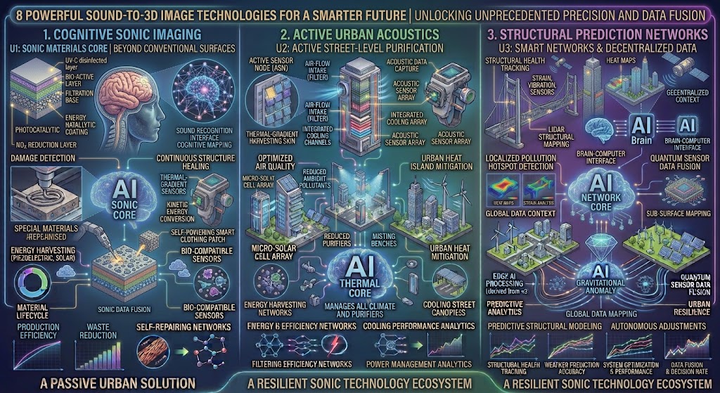
The returned signal contains information about distance, surface characteristics, movement, and sometimes the shape or structure of objects. Computer processing then converts this information into an image or another form of spatial representation.
Synthetic aperture radar is one of the best-known examples. NASA explains that SAR can produce fine-resolution images by combining radar measurements collected as the radar moves relative to the observed area.
This means the “camera” does not necessarily need a large physical lens or optical sensor. Instead, movement, signal timing, antenna geometry, and computation can work together to create an image.
How Radio Imaging Technologies Work
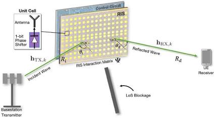
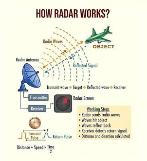
The basic operation of many Radio Imaging Technologies starts with a transmitter sending an electromagnetic signal toward an area of interest. When the signal encounters an object or surface, some of its energy is reflected or scattered back toward a receiver.
The system records characteristics of the returning signal. These can include signal strength, timing, frequency, phase, and polarization. Computer algorithms then process these measurements to estimate where objects are located and how they interact with the radio waves.
The process is more complicated than taking a normal photograph because radio signals can reflect from multiple surfaces and interact with buildings, vegetation, vehicles, terrain, and other objects.
NIST research on through-barrier sensing notes that lower radio frequencies can generally penetrate nonmetal barriers more effectively, although lower frequencies also tend to provide lower spatial resolution.
Signal Processing in Radio Imaging Technologies
Signal processing is therefore one of the most important parts of Radio Imaging Technologies. The raw measurements are not usually a ready-made picture. Algorithms must interpret echoes and reconstruct the spatial information.
This is why modern radio imaging depends heavily on mathematics, computing, antenna design, and image reconstruction.
Synthetic Aperture Radio Imaging Technologies
One of the most powerful categories of Radio Imaging Technologies is synthetic aperture radar, commonly called SAR.
SAR creates high-resolution images by using the movement of a radar platform to simulate a much larger antenna aperture. The platform can be an aircraft, drone, satellite, or another moving system.
NASA explains that SAR records radar echoes repeatedly as the radar moves along its path. Computer processing uses the changing distance and phase history of the returned signals to focus the measurements into a detailed image.
Space-Based Radio Imaging Technologies
Space-based SAR is especially valuable because radar can collect information during darkness and under many cloudy conditions. ESA explains that SAR systems operating at microwave frequencies can acquire imagery in conditions where traditional optical cameras may be limited.
This makes Radio Imaging Technologies important for observing forests, ice, wetlands, infrastructure, coastlines, agriculture, and changes to Earth’s surface.
Modern satellite missions are pushing this technology further by combining high-resolution radar observations with advanced processing and repeated measurements.
Radar-Based Radio Imaging Technologies
Radar is another major branch of Radio Imaging Technologies. Traditional radar can determine the distance and movement of targets by analyzing returned electromagnetic signals.
When radar systems use multiple antennas, wide bandwidths, advanced signal processing, or synthetic apertures, they can move beyond simple target detection toward detailed imaging.
NASA describes the basic principle of imaging radar as transmitting electromagnetic signals and measuring the strength and time delay of the returned backscatter.
3D Radio Imaging Technologies
Advanced radar systems can also collect information from different angles or positions. With appropriate antenna arrangements and processing, this information can be used to reconstruct three-dimensional structures.
NIST operates a large-aperture radar scanner capable of reconstructing three-dimensional holographic images from radar data. Its research applications include imaging through building materials and detecting concealed objects.
This demonstrates how Radio Imaging Technologies can move from simple two-dimensional radar maps toward more detailed spatial sensing.
Through-Wall Radio Imaging Technologies
One of the most unusual applications of Radio Imaging Technologies is through-wall sensing. Because certain radio frequencies can penetrate some nonmetal materials, researchers can use radar systems to detect objects or movement that is not directly visible.
NIST has researched through-barrier sensing using radio frequencies, including systems designed to identify humans behind optically opaque barriers.
In a 2021 demonstration, NIST researchers described a microwave imaging system called m-Widar that produced images of hidden and moving objects and demonstrated imaging through drywall.
Radio Imaging Technologies for Emergency Response
Through-wall imaging could have potential applications in emergency response. In a smoke-filled or partially collapsed building, conventional cameras may not provide enough information.
A radio-based system could potentially help responders determine whether people are present behind certain barriers or locate movement that cannot be directly seen.
However, real-world performance depends strongly on the building materials, radio frequency, antenna configuration, distance, and signal processing. It should therefore be treated as a specialized sensing technology rather than a universal replacement for cameras.
Ultra-Wideband Radio Imaging Technologies
Ultra-wideband systems are another important part of Radio Imaging Technologies. Instead of operating over a very narrow frequency range, UWB systems use a broad range of frequencies.
The larger bandwidth can improve range resolution because the system can distinguish differences in signal travel time more precisely.
NIST research has explored UWB radar for through-wall imaging and notes that bandwidth is connected to fine range resolution, while antenna aperture also affects cross-range resolution.
Building Inspection with Radio Imaging Technologies
UWB radio imaging can also be useful for examining building materials. NIST research demonstrated the use of ultra-wideband radio signals to detect moisture accumulation inside wall assemblies. Reflected signals were analyzed to identify areas associated with unwanted moisture.
This creates an interesting application of Radio Imaging Technologies beyond security or surveillance. The same general principles can support non-destructive inspection of buildings and materials.
Passive Radio Imaging Technologies
Not all Radio Imaging Technologies have to rely entirely on actively transmitting a dedicated imaging signal. Passive approaches can use existing electromagnetic signals or naturally available radio sources, depending on the application.
The basic idea is to observe how existing signals interact with an environment. Changes in reflections, scattering, or signal strength can contain information about objects.
Passive radio imaging can be attractive because it may reduce the need for a dedicated transmitter, although it also introduces additional challenges related to signal availability, synchronization, interference, and image reconstruction.
Future systems may combine passive and active sensing to increase the amount of information available to an imaging algorithm.
AI-Powered Radio Imaging Technologies
Artificial intelligence is becoming increasingly important in Radio Imaging Technologies because raw radio measurements can be extremely complex.
Machine-learning models can potentially assist with object recognition, signal classification, noise reduction, image reconstruction, and interpretation. Instead of requiring every stage to be manually programmed, AI systems can learn patterns from large collections of radio measurements.
Computational imaging was already central to the NIST m-Widar system, which used signal processing and mathematical reconstruction techniques to convert measurements into images.
Future AI systems could make radio images easier for machines to interpret. A robot, for example, could potentially use radar measurements to build an environmental model and then use AI to classify objects within that model.
Smarter Radio Imaging Technologies
The combination of AI and radio sensing could eventually create systems that do more than produce pictures. They could detect changes, identify unusual patterns, track moving objects, and provide predictions based on repeated measurements.
This could make Radio Imaging Technologies particularly valuable for autonomous machines that need environmental information without depending entirely on visible-light cameras.
Applications of Radio Imaging Technologies
Radio Imaging Technologies already have applications across several fields. Satellite SAR is used for Earth observation, while radar imaging can support mapping, infrastructure monitoring, and environmental analysis.
In emergency response, through-wall radio imaging research has explored ways to detect people behind barriers. In construction and building science, UWB radio systems have been investigated for identifying moisture inside wall assemblies.
Robotics is another promising area. A robot equipped with radar imaging could potentially sense objects under conditions where optical cameras are less effective.
Vehicles may also benefit from combining radar information with cameras, LiDAR, and other sensors. Rather than relying on one type of perception, future autonomous systems could combine multiple sensing methods to create a richer understanding of their surroundings.
Comparison of Radio Imaging Technologies
| Radio Imaging Technology | Main Signal | Main Strength | Potential Application |
|---|---|---|---|
| Synthetic Aperture Radar | Microwave radar | High-resolution mapping | Satellites and aircraft |
| Radar Imaging | RF/microwave | Distance and movement detection | Vehicles and robotics |
| Through-Wall Imaging | RF/microwave | Detects beyond barriers | Emergency response |
| Ultra-Wideband Imaging | Wide RF spectrum | Fine range information | Building inspection |
| Passive Radio Imaging | Existing RF signals | Reduced dedicated transmission | Smart environments |
| 3D Radar Imaging | Multiple RF measurements | Spatial reconstruction | Industrial sensing |
| AI Radio Imaging | Processed RF data | Automated interpretation | Autonomous machines |
The table shows that Radio Imaging Technologies are not one single technology. They represent a broad family of systems that use radio signals, antennas, movement, and computational processing in different combinations.
Illustrative Technology Comparison
The following chart is illustrative only. The scores represent the breadth of applications discussed in this article, not measured market performance or a scientific ranking.
Challenges of Radio Imaging Technologies
Despite their potential, Radio Imaging Technologies have important technical limitations. Radio signals interact strongly with the environment, and buildings, vegetation, terrain, vehicles, and other objects can create reflections and interference.
Spatial resolution is another challenge. Radio wavelengths are generally much longer than visible-light wavelengths, so achieving very fine detail can require sophisticated antenna arrays, wide bandwidths, synthetic apertures, or computational processing.
NIST notes that lower frequencies can improve penetration through some nonmetal barriers but generally provide lower spatial resolution.
Processing requirements can also become significant when systems collect large amounts of radar data. High-resolution imaging may require specialized hardware and advanced algorithms.
Another challenge is image interpretation. A radio image does not always look like a normal photograph, and factors such as surface roughness, geometry, polarization, and signal scattering can affect what appears in the final image. NASA specifically notes that interpreting SAR imagery requires understanding its unusual side-looking geometry and backscatter behavior.
Future of Radio Imaging Technologies
The future of Radio Imaging Technologies will likely depend on better antennas, faster processors, improved algorithms, smaller sensors, and stronger AI models.
One promising direction is sensor fusion. A future machine could combine radio imaging with optical cameras, LiDAR, thermal sensors, and other technologies. Each sensor would provide a different type of information.
Another direction is miniaturization. As radar electronics become smaller and more efficient, advanced imaging could become easier to integrate into robots, drones, vehicles, industrial equipment, and portable inspection systems.
Research into through-wall and hidden-object imaging could also continue developing. NIST’s current through-barrier sensing work demonstrates that radio-frequency imaging can be adapted to different barriers and sensing requirements.
Satellite imaging will remain another major area. SAR can operate without depending on sunlight and can provide useful observations through many cloudy conditions, making it valuable for Earth observation.
The long-term direction is therefore not simply “radio cameras.” It is the development of machines that can interpret electromagnetic information as a form of digital vision.
Conclusion
Radio Imaging Technologies are turning invisible electromagnetic signals into useful images and spatial information. Synthetic aperture radar, through-wall imaging, ultra-wideband systems, 3D radar, passive sensing, and AI-assisted reconstruction demonstrate how radio signals can become far more than communication tools.
The most interesting part is the ability to sense environments where ordinary cameras have limitations. Radio imaging can work in darkness, provide information from radar reflections, and in specialized systems even reveal objects behind certain nonmetal barriers. NIST research has demonstrated real-time microwave imaging of hidden and moving objects, while NASA and ESA continue to use SAR principles for detailed Earth observation.
As hardware becomes smaller and computational processing becomes more powerful, Radio Imaging Technologies could become an important part of future robotics, autonomous vehicles, infrastructure inspection, emergency response, and intelligent sensing systems.